UNDERWATER CAVE SURVEY & CARTOGRAPHY
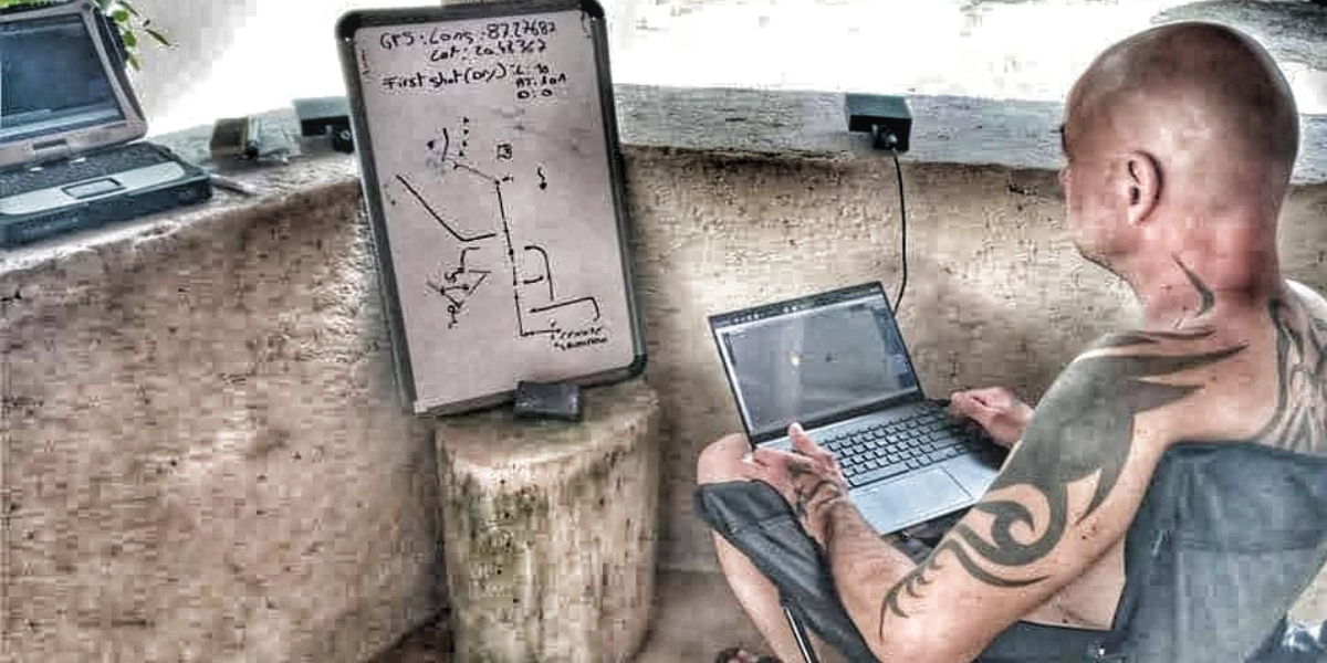
The Underwater Cave Survey & Cartography Diver course is a training designed to learn how to map, explore and measure underwater caves. During the training, students will learn the techniques of collecting measurements, laying exploration ropes, documentation using video cameras, and drawing cave plans. The Underwater Cave Survey & Cartography training is dedicated not only to previously unexplored cave systems, but also to applying new data to previously drawn maps, which are often not as accurate as we might think. New measurement concepts and new measurement technologies offer much greater possibilities than in earlier years when maps were created, which are widely used to this day.
STUDENT PREREQUISITES
- Full Cave Diver license
- logged in at least 50 non-training cave dives
REQUIRED EQUIPMENT (apart from cave diving equipment)
Equipment needed to make cave measurements (Cave Survey Slate, Wall Survey Slate, Survey Station Markers, manual sonar for measuring distances, MNemo tool, necessary software) - are provided by the instructor conducting the course.
DURATION
4 days
PRICE
280 EUR per day + 80 EUR certificate and manual
420 EUR per day individual course + 80 EUR certificate and manual
Price does not include:
Gas, tanks and required student's diving equipment
Gas, dive site entry fees and the instructor's stay costs (accommodation, flight etc) - for courses done away from Spain